- Steering group and management
- Sub-projects
- Jelling in GIS (Geographic Information System)
- Geophysical survey at Jelling
- Fieldwork 2011
- Archaeological fieldwork 2010
- Archaeological fieldwork 2009
- Jelling’s large stones
- The landscape around Jelling
- Place names in Jelling and its vicinity
- The bridge over Ravning Enge
- The travertine churches of East Jutland.
- Rune stones in context 2011
- Power and coins 2009
- Exhibitions
- Digitizing the photographs
Boreholes in the North and South Mound 2009
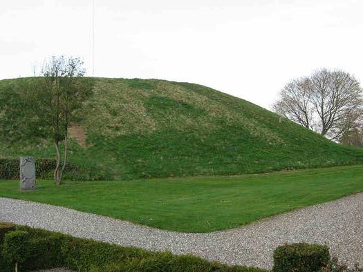
The two mounds at Jelling are an important source of information about the landscape of the Viking Age. Even in the 1940s their massive build-up of turfs was so well preserved that the turf layers could be removed and individual turfs taken out. In August-September 2009 6-8 boreholes will be made in the North and the South Mounds. From every borehole around 8 soil samples will be taken. The samples will then be analysed for texture, organic material, iron and aluminium. The boreholes and the subsequent analysis of the samples will be undertaken in close cooperation with the National Museum’s Natural Sciences Department.

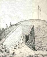
- Evidence of the 19th century digging into the south side of the North Mound photographed in April 2009. Photo: Anne Pedersen.
The aim of the boreholes in the Jelling mounds
The boreholes will help clarify whether a new excavation into one or both of the mounds will give new information about their composition and construction. Preserved pollen and plant remains in the soil and the turfs will shed light upon the local and regional development of the landscape in the time around the mounds’ construction. At the same time the boreholes will provide information about the turf’s nature and origin.
Project participants: Professor Henrik Breuning-Madsen, Department of Geography and Geology, University of Copenhagen; Museum Inspector Charlie Christensen, the National Museum and Assistant Professor Mads Kähler Holst, Section for Prehistoric Archaeology, Aarhus University.


