 |
Jelling North – August 2009
Early in the morning of Monday August 17th the machines started up at Jelling North. The aim of the archaeologists is to investigate the area north and north-east of the Jelling mounds and the palisade found by Vejle Museum in 2006. They hope to find out whether there are traces of settlement, workshops or other activity from the Viking Age.
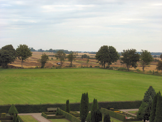
- View from the North Mound of trial trenches between the Jelling monuments and the Many Mounds to the north. Photo: Anne Pedersen.
A single house
In the course of the first two weeks the two large machines have removed approximately 10 kilometres of trenches from south to north. The trenches can already be seen from a long distance as straight rows, with small regular heaps of soil along the sides. However, the archaeological evidence is still waiting to be seen. Apparently it is not here that the Viking Age farms are to be found. On 27th August traces of a building appear in the third to last trench farthest to the east, on the east side of the farm Nørrelide. There is no doubt over this, with the dark post holes standing out clearly against the yellow natural sands and gravels. The trial trench was therefore extended in width so that the whole house, or the ground plan of it, was exposed. Centuries of ploughing have eroded down the area and the plan of the building is incomplete. It can nevertheless be worked out.
The building is 23.5m long. It had slightly bowed long walls and straight end walls. Along the outer walls was a row of supporting posts. A so-called Trelleborg house has been suggested. This house type gets its name from the ring fortress of Trelleborg on Zealand, where the archaeologists encountered it during the excavations of 1934-43. Two sets of roof-bearing posts divided the inside of the house into three rooms. There was a smaller room, one fifth of the length of the building, at each end wall and a large middle room of three fifths of the building length. The coming weeks will show whether there are further archaeological remains in the area.
An area of small lakes
Further post holes in the trial trenches further to the west are probably somewhat earlier and represent scattered Iron Age activity. However, that the traces of settlement are so limited, is a surprising new finding about the landscape of the past. The fields north of the Jelling monuments previously contained numerous areas of water. Many of these appear to have been small lakes connected to streams. Perhaps the area was unsuitable for settlement during the Viking period.
The small lakes or ponds appear as areas of dark brown peat and the spoil heaps along the trial trenches suddenly change colour. Boreholes into two of the most promising hollows show that the peat and mud here continues down to at least 3.5 and 5.5 metres in depth. This should enable detailed pollen analysis and hopefully create the basis for a reconstruction of the vegetation environment. Samples of the layers will be analysed at the National Museum and with luck produce a picture of the landscape as it looked in the past. It may even be possible to find out the effect that the Jelling monuments had upon the development of the vegetation of the local environment.
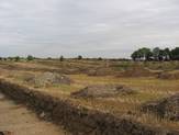
- The excavation covers a large area and a long distance from north to south. Photo: Anne Pedersen.

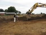
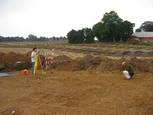
- The trial trenches east of the farm Nørrelide, where the first house of the excavation appeared, is extended in width. Photo: Anne Pedersen.

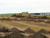
- The machines remove the plough soil and the archaeologists clean up to expose all the details. Photo: Anne Pedersen.

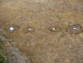
- Four post holes show the course of the house’s east end wall. Photo: Anne Pedersen.

- The house is recorded and measured in. In the background the trial trenching continues to the south-west. Photo: Anne Pedersen.

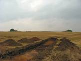
- Peat layers seen as dark areas in a trial trench in the far north near the Many Mounds. Photo: Anne Pedersen.
