- Gorm, Thyra and Harald
- The rune stones
- Gorm the Old’s rune stone
- Harald Bluetooth’s rune stone
- Basse’s rune stone
- How are rune stones read?
- The rune stones past and present
- Henrik Rantzau’s view, 1591
- Jon Skonvig, 1627
- Søren Abildgaard, 1771
- Ole Jørgen Rawert, 1819
- Adam Müller, 1835
- Jakob Kornerup, 1861
- Julius Magnus-Petersen, 1869-71
- Julius Magnus-Petersen, 1878
- Hans Andersen Kjær, 1897
- Photographs by a member of the public, 1935
- Runologist Erik Moltke, 1971
- Ludvig Stubbe-Teglbjærg’s rubbings, 1973
- Peter Henrichsen, moulding and copying in 1984
- Roberto Fortuna, 2006
- The conservation investigation 2006-08
- 3D light scanning, 2007
- Harald Bluetooth’s rune stone at home and abroad
- Pictures from Jelling
3D light scanning, 2007
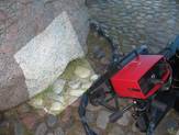
As part of the investigation of the two rune stones at Jelling in 2006-08, a piece of new technology known as 3D light scanning was used to document the present physical extent of the stones in three dimensions. First a local spatial system of coordinates was established when fixed points, small circular stickers, were temporarily stuck onto the rune stones. The labels were evenly placed over the surface at intervals of 20-30 cm. In addition, larger measuring labels were placed upon the stones as part of preliminary recording. Using a hand-held, high resolution photogrammetric digital camera the exact spatial positions of these fixed points and measuring labels were recorded. A software programme grouped the fixed points together into a well-defined spatial coordinate system on the surface of the rune stones.
The stone surfaces were then measured with a light scanner. A light source sent patterns (stripes) of white light over the stone surface whilst the patterns were observed with two high resolution cameras. Based on the observations the computer gathered automatic 3D coordinates (x, y and z values) for each individual camera pixel. From these point observations the software was used to establish tiny little triangular surfaces between the points. Nine points were recorded for every mm2 of the surface and the absolute accuracy is +/- 0.022 mm.
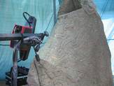
The National Museum has possessed copies of both rune stones since 1984 and therefore it was also possible to light scan their three-dimensional extent. Copies can be regarded as snapshots of an object’s spatial form at a given point in time. The scans of the original and copy were digitally placed on top of one another and compared in selected areas. Thus digital images of the comparison could be produced. Green indicates similarity between past and present (1984 and 2007). Red and blue shades indicate difference between past and present. Red shows loss of material, whilst blue shows growth of material, such as lichen.
The copies were originally thought of as a piece of documentation for the year 1984. However, using the light scanning it is now possible to wrest more information out of them. Together with the originals, they document a negative development, in other words loss of rock material. The investigation revealed that unfortunately a loss of material from both rune stones has occurred since 1984.


